All proposed road networks must in some way connect to an existing road network. Connecting to an existing road in the form of a T-Junction is an important feature that can be easily designed in Site3D.
This page describes the how to use Site3D's automated junction facility to connect your proposed road to an existing road on your topographical survey to precisely match the levels and grades:
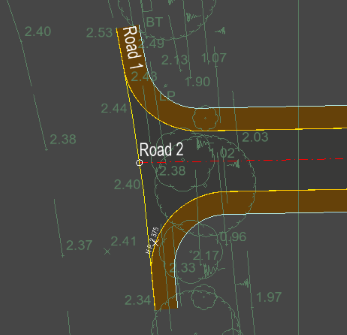
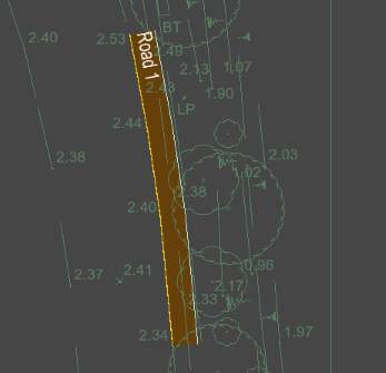
First, place a new centreline along the channel of the existing road, over just the region where your new road will junction on to it. You can use the snap tools to latch it precisely on to the lines on the survey model. You only need to draw enough to cover the new junction region:
Add a channel, kerb and footway (as required) to this short stretch of centreline on only the side facing the incoming proposed road.
The road we are specifying needs to have its width set to zero because we are designing it along the channel rather than the exiting centreline.
Also, set the other side to have no channel, kerb or footway (do this by deselecting the Right is duplicate of left option):
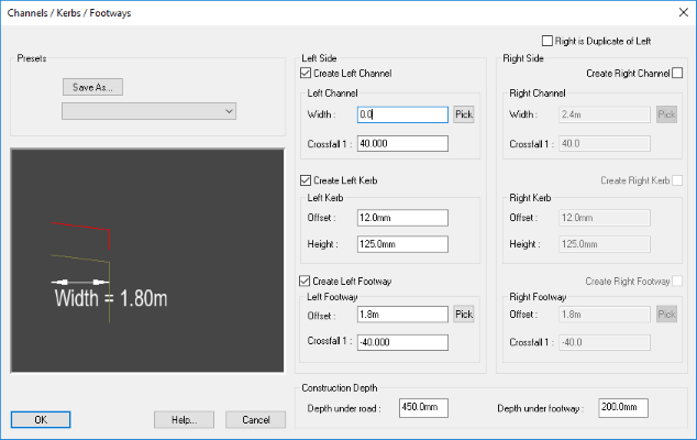
(NOTE: Don't be tempted to specify the crossfall as zero, as that would indicate a vertical road surface!)
The 'road' will look something like this:
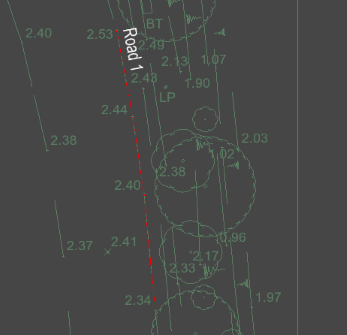
Now you can match this road to the existing ground levels. Use the Road->Centreline Extras->Level to Survey... menu option. Select this short road. A warning will appear informing you that the vertical alignment will be removed and replaced with one that matches the current survey surface. Click OK to accept.
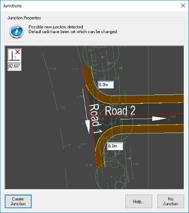
The junction can now be created as you would any other normal road junction in Site3D.
Move the incoming proposed road end near the zero width road and a junction will be offered:
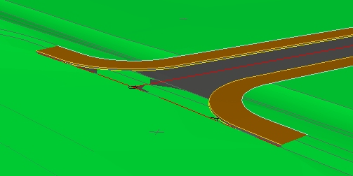
The final result shown in 3D below highlights how the proposed road precisely ties into the existing road surface at the junction.