Drainage trenches are automatically generated for the drainage network, and updated automatically updated whenever manholes or conduits are added or modified. The 3D trench represents the volume around the manhole/conduit which would be excavated during construction and so would need to be taken into account when calculating earthwork volumes.
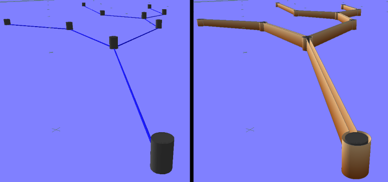
The left hand side of the image above shows a simple drainage network and the right hand side shows the same simple network with the trenches shown.
To show/hide the trenches, simply turn on/off the DRAINAGE_TRENCH layer in the Layers window ![]()
For manholes, trenches are created 150mm offset from the outer edge of the manhole and 225mm below the base of the manhole.
For conduits, the trenches are created 150mm offset from the outside of the conduit and 150mm below the bottom of the conduit.
The top of trench is levelled to the Current Survey surface.
The Drainage Trenches are automatically recalculated when the drainage network is modified and so will always be up-to-date.
The trenches can be exported, in both 2D and 3D, by including the drainage trench layer when exporting.