Intuitive Civil Engineering Design Software Designed By Engineers For Engineers
Road Networks Made Easy
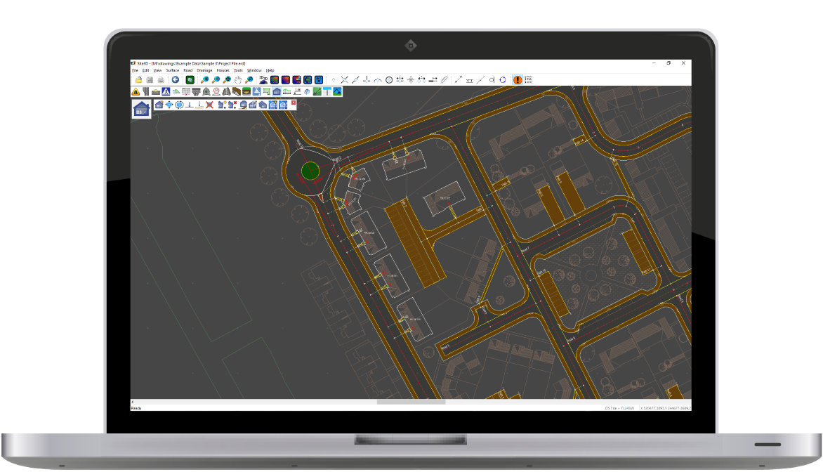
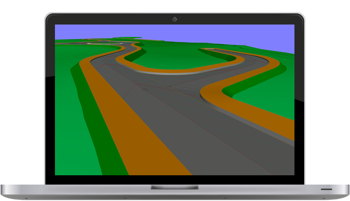
Site3D is capable of handling both complex road networks with varying width roads as well as major highways, link roads and bypasses. Site3D's automatic junctioning makes linking roads a breeze.
Volume Calculation and Isopachyte bands
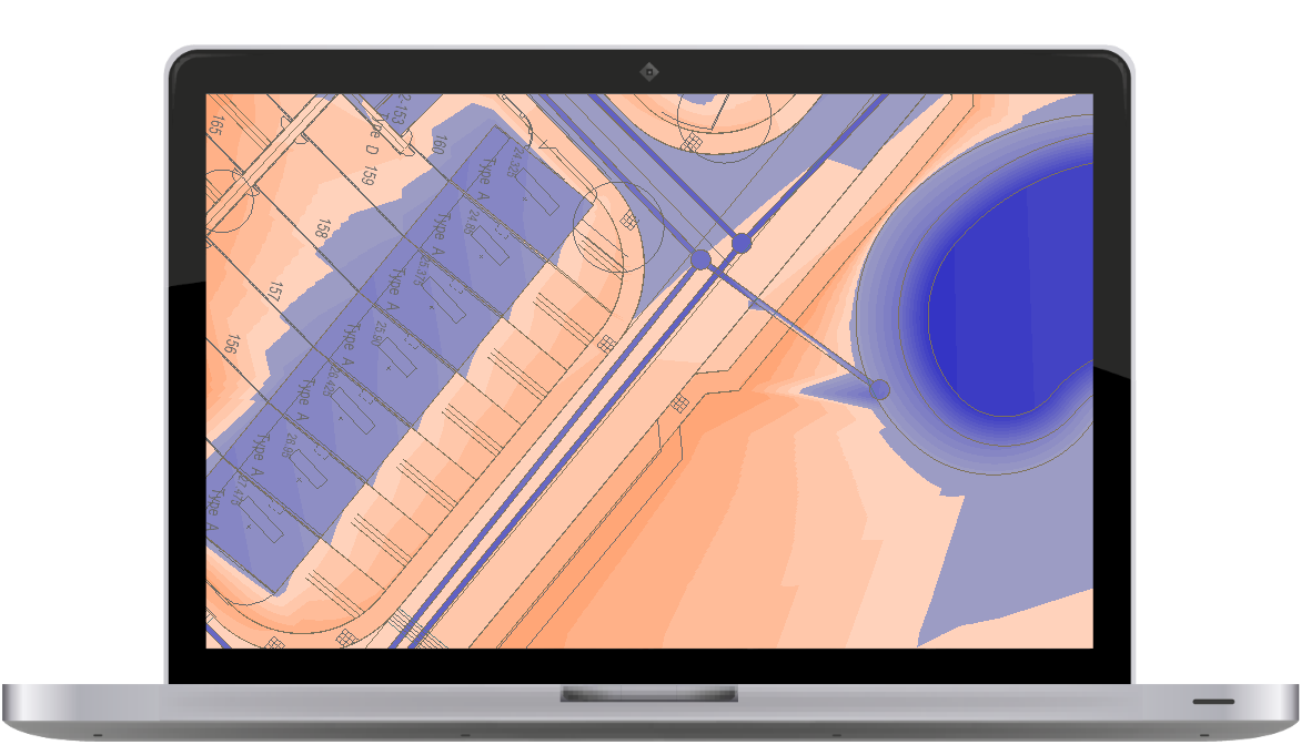
One click formation surface generation with instant cut and fill volume calculation and automatic isopachyte depth banding at the touch of a button.
BIM
Easily integrate Site3D into your BIM collaboration system by simply exporting the design in the BIM IFC file format. The IFC file loads straight into your BIM collaboration software of choice (e.g. Revit / Navisworks), including layer naming which follows the BS1192:2007 guidelines, and solid objects with their design attribute information.
3D Junctions
Junctions automatically calculate the optimal vertical kerb-return design to tie the roads together both horizontally and vertically. Whenever design changes are made, the intelligent 3D junctions automatically update to maintain the specified engineering criteria.
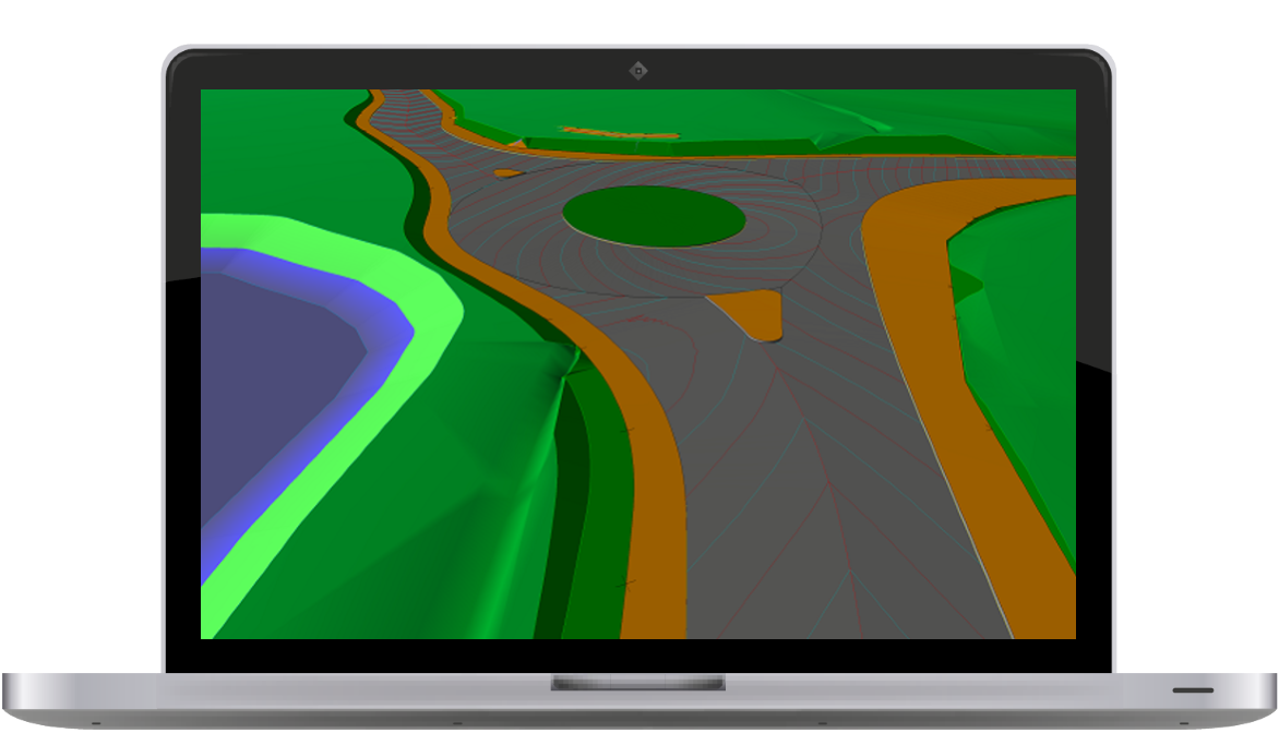
3D Roundabouts
Create fully 3D roundabouts in seconds that use the DMRB guidelines. Vehicle driving deflection is calculated automatically so that it is always up-to-date after any design change. The automatic model recalculation means you can simply drag junctions around in seconds and observe the effects of the changes to allow for optimal roundabout design.
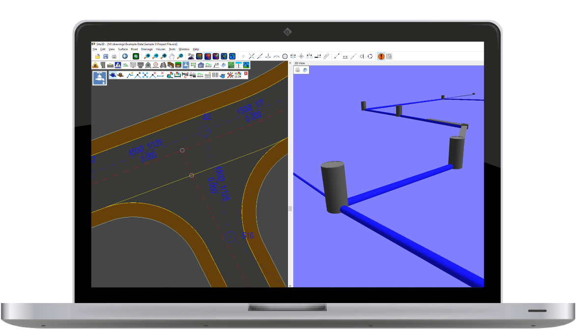
Drainage
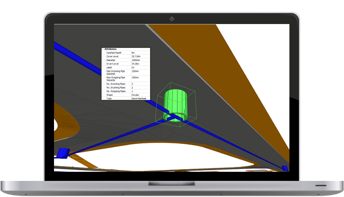
Create drainage networks by placing manholes along the desired runs, then let Site3D auto-size and level the network according the surface cover levels, drainable areas and rainfall profile. Drainage is automatically displayed and annotated on long-sections and instantly updated to show changes. Drainage simulations are run directly in Site3D, or export and import with your favourite drainage package.
Earthworks
Create varying interface grades from the edge of your designs to a ground model of your choice. Stepped grades can be easily added for utility strips and other linear design features along the side of roads like swales.

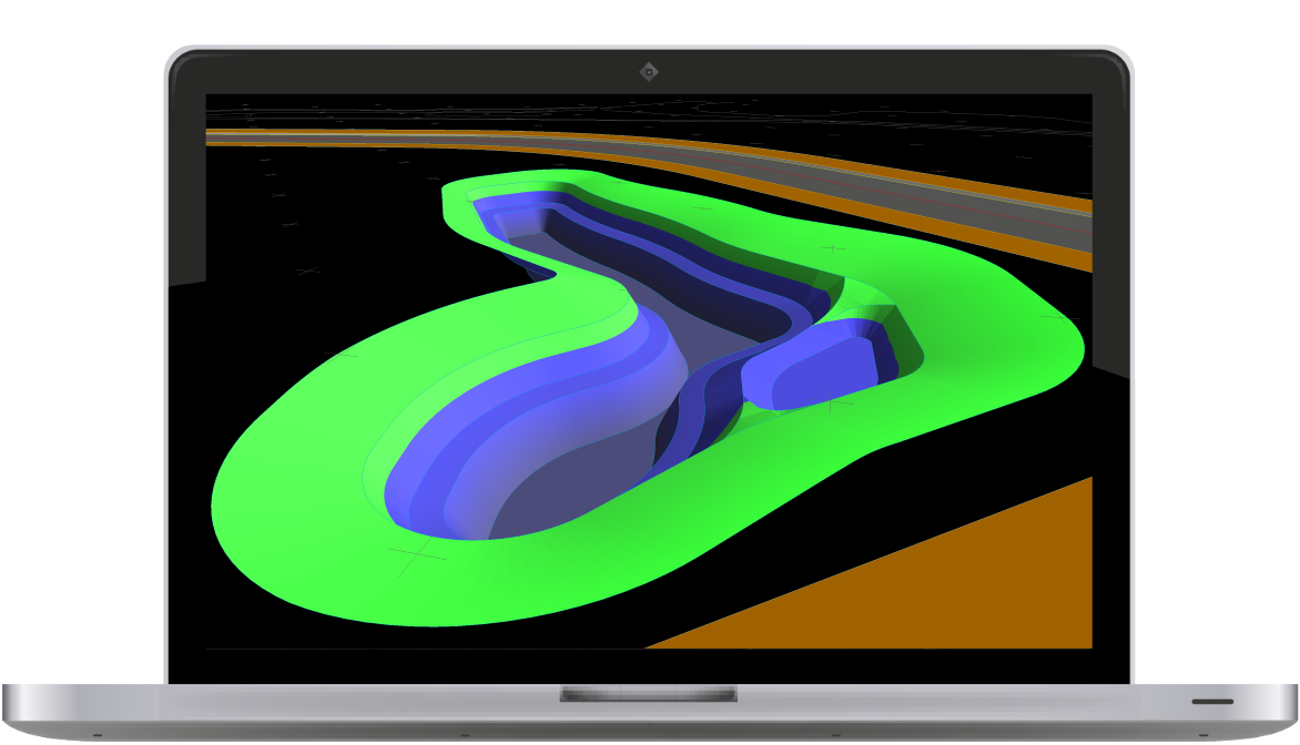
Ponds
Ponds can be easily designed in Site3D. Dynamic cut and fill volumes, as well as water storage volumes, update as you define the pond shape and profile, allowing you to tailor the design to the job specification in minutes.
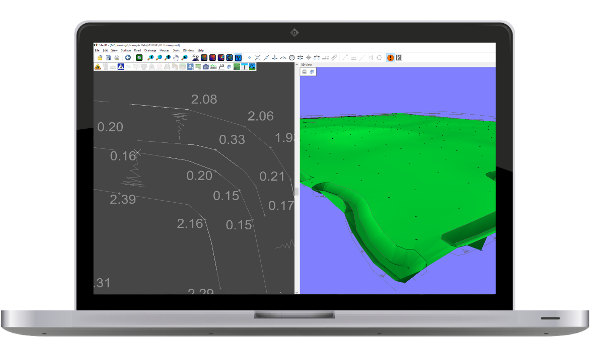
One-click 2D to 3D Converter
Site3D reads every level text and automatically and intelligently finds the appropriate insertion point. Site3D also assigns levels to the 2D feature lines to form an accurate surface that has surface features well defined in the converted 3D surface.
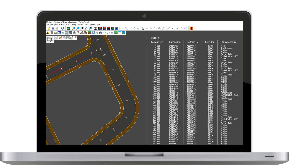
Dynamic Setting Out
Site3D automatically updates the annotated coordinate and setting-out tables whenever the design changes in any way. This means the setting-out information is always up-to-date.